
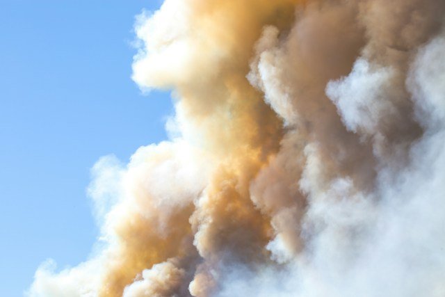
LAS VEGAS, Nev. Both ends of Nevada spent Wednesday under an air quality warning, and neither one traces back to a fire burning in the state. Clark County issued a two day smoke advisory for the Las Vegas Valley on Sept. 16, attributing it to a wildfire burning northeast of Ensenada, Baja California, Mexico, roughly 417 miles away by road.
The same day, Northern Nevada Public Health issued its own advisory for the Reno-Sparks area, pointing to two separate fires, one right at the California line and one deep in Yosemite National Park, 158 miles to the west.
Add it up and Nevada’s two biggest population centers were breathing smoke from three fires on the same day, and not one of them was burning inside the state.
The Fire Closest to Reno Is Still in California
The Floriston Fire started around 10 a.m. Wednesday near Interstate 80 and Floriston Way, about 9 miles northeast of Truckee, in Nevada County, California, according to CAL FIRE’s own incident page.
Despite the county’s name, the fire is not in the state of Nevada, though it sits close enough to it that it shut down one of the state’s main highways and pushed evacuation warnings across the border.
The fire grew fast. CAL FIRE logged it at 20 acres by late Wednesday morning. By early afternoon it had reached 300 acres and 5% containment.
By Wednesday evening it was up to 613 acres, and as of Thursday afternoon it remained 613 acres and 5% contained, with no injuries, deaths or structure losses reported in any update.
Interstate 80 westbound has been closed at the Nevada state line since Wednesday, with the Nevada Department of Transportation recommending drivers avoid the route entirely for at least a day.
Evacuation orders remain in place for one Nevada County zone, evacuation warnings cover several more zones in Nevada and Sierra counties, and a Level 1 “Be Ready” warning was issued for part of Washoe County itself, south of Mogul. NV Energy reported 131 customers without power as of Thursday, with no restoration estimate given.
Smoke from the fire pushed the air quality index in Verdi to 109, unhealthy for sensitive groups, Wednesday into Thursday.
A Second, Farther Fire Is Smoking Out Sparks
The Reno area’s air quality problem is not coming from one fire, it is coming from two. The Dome Fire started Sept. 15 north of Wawona Dome inside Yosemite National Park, in Mariposa County, California, and had grown to 1,177 acres with zero containment as of Wednesday afternoon, according to CAL FIRE, which lists the National Park Service as the managing agency.
Yosemite National Park sits roughly 158 miles from Reno by road, according to Rome2Rio’s driving distance calculation, yet smoke from the Dome Fire was enough to push air quality in eastern Sparks and Spanish Springs into the moderate range Wednesday into Thursday, per Northern Nevada Public Health’s advisory.
417 Miles South, an Entirely Different Fire
Las Vegas Valley’s smoke problem has nothing to do with either the Floriston or Dome fires. Clark County’s Division of Air Quality attributed its Sept. 16 to Sept. 17 advisory specifically to a wildfire burning in mountainous terrain northeast of Ensenada, Mexico, more than 400 miles south of the Las Vegas Valley. Clark County’s advisory did not release a specific air quality index reading for the Las Vegas Valley, so this article is not reporting one.
The county recommended residents stay indoors when smoke is visible or detectable by smell, set home and vehicle ventilation systems to recirculate rather than draw in outside air, and postpone outdoor exercise while daytime temperatures sat in the upper 90s, conditions the county said accelerate ground level ozone formation on top of the smoke itself.
Three Fires, One Table
| Fire | Location | Size as of Sept. 16 to 17 | Containment | Distance to nearest Nevada metro | Nevada area affected |
|---|---|---|---|---|---|
| Floriston Fire | Nevada County, California | 613 acres | 5% | About 9 miles from Truckee, on Reno’s doorstep | Verdi, North Valleys, southern Washoe County |
| Dome Fire | Yosemite National Park, California | 1,177 acres | 0% | About 158 miles from Reno | Eastern Sparks, Spanish Springs |
| Ensenada area wildfire | Baja California, Mexico | Not released | Not released | About 417 miles from Las Vegas | Las Vegas Valley |
What’s Actually Burning Inside Nevada Right Now
Nevada does have its own active fires this week, they simply are not the ones behind either smoke advisory. The state’s largest, the McConnell Fire near Winnemucca in Humboldt County, was sparked by lightning in late August and had grown to 33,562 acres before crews reached 92% containment, with national forest closures already lifted. Winnemucca sits about 165 miles from Reno, in the opposite direction from the smoke now drifting over the Truckee Meadows.
A second, much smaller fire broke out near the old Binion property in Pahrump on Wednesday afternoon, reported around 1:30 p.m. and placed under control by 3 p.m. the same day, at roughly 50 unconfirmed acres.
Clark County’s own advisory does not attribute any part of the Las Vegas Valley’s smoke to the Pahrump fire, pointing instead to the wildfire near Ensenada, Mexico, described above.
Tracking Conditions as They Change
- Southern Nevada: Clark County’s air quality forecasts are posted at DESAQMonitoring.ClarkCountyNV.gov, with text and email alerts available through enviroflash.org.
- Northern Nevada: Northern Nevada Public Health directs residents to the AirNow Fire and Smoke Map and the AirNow mobile app for real time readings near the Floriston and Dome fires.
- Statewide: CAL FIRE’s incident pages for the Floriston Fire and Dome Fire update containment and acreage as crews report it.
- Highway status: The Nevada Department of Transportation is advising against westbound I-80 travel near the state line until the Floriston Fire closure lifts.
This week is not an outlier for Nevada’s fire season. On Sept. 11, the National Weather Service offices in Elko, Las Vegas and Reno all issued fire weather warnings covering nearly the entire state, citing wind gusts up to 45 mph and humidity as low as 5 to 9%. “We are still within fire season for our area, fire season in Nevada doesn’t typically end until October,” NWS Elko meteorologist William Vinson said at the time.
Fire size, containment, cause, location and personnel figures for the Floriston Fire are drawn from CAL FIRE’s own incident page, fetched directly, and cross checked against KOLO TV’s Sept. 16 and Sept. 17 reports and 2 News Now’s Sept. 17 report on the same fire. The 109 AQI reading for Verdi and the 131 customer power outage figure are from 2 News Now’s reporting. Dome Fire size, containment, start date and location are from CAL FIRE’s own incident page for that fire. The Reno area health guidance and the areas affected by each fire are from Northern Nevada Public Health’s advisory as reported by KOLO TV and This Is Reno on Sept. 16. The Las Vegas Valley advisory’s attribution to a wildfire near Ensenada, Mexico, its two day duration, and its health guidance are from Clark County’s own press release and Nevada Globe’s Sept. 16 report on it; no AQI figure for the Las Vegas Valley was found in a live source, so none is reported. The McConnell Fire’s peak acreage and current containment are from 2 News Now’s report on that fire. The Pahrump fire’s size, timing and control status are from News3LV’s Sept. 16 report. Driving distances, Las Vegas to Ensenada at 417 miles, Reno to Yosemite National Park at approximately 158 miles, and Winnemucca to Reno at 165 miles, were pulled from independent mapping services (DistanceCalc.com and DriveDistance.com agreeing on the Ensenada figure, and Rome2Rio for the Yosemite figure) and are approximate road distances, not straight line distances. The Sept. 11 statewide fire weather warning and the William Vinson quote are from Newsweek’s Sept. 11 report and are presented as background on the broader fire season, not as current conditions. This publication searched specifically for existing coverage connecting the Las Vegas Valley’s and Reno’s simultaneous smoke advisories to the actual distances involved and to what is or is not burning inside Nevada’s own borders, and found only single city, single fire coverage in each local outlet, with no source making this statewide comparison as of Sept. 17, 2026.