

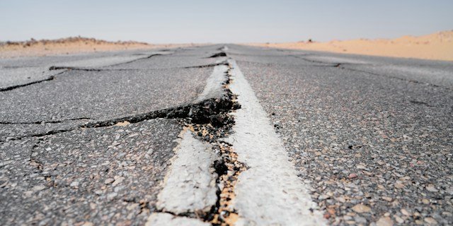
RENO, Nev. Two earthquakes of magnitude 4.1 struck west of Preston in White Pine County early Sunday morning, the largest in a cluster of at least seven tremors the U.S. Geological Survey recorded in the area over the course of Sunday.
The swarm hit in eastern Nevada, the exact region that state seismologists have publicly identified as having the thinnest earthquake monitoring coverage in Nevada, a gap they are only now beginning to plan for.
Nevada does not have an earthquake early warning system. California, Oregon and Washington have had one, called ShakeAlert, since 2019. In February, Rep. Mark Amodei’s office announced that Congress had approved $34.85 million in funding tied to Nevada’s ShakeAlert expansion, a figure multiple Nevada outlets then repeated in headlines as money for Nevada.
Read closely, the underlying appropriation is for the existing West Coast system, with language directing the USGS to start planning a Nevada expansion.
What Nevada has actually been awarded toward that expansion, according to the University of Nevada, Reno, is a $300,000 cooperative agreement with the USGS, covering planning work only.
A Swarm in the Part of Nevada With the Fewest Sensors
The two magnitude 4.1 quakes struck roughly 20 kilometers west of Preston, a small White Pine County community, in the first hours of Sunday, Sept. 27, according to USGS records. Smaller aftershocks between magnitude 2.5 and 3.3 continued into Sunday night. No damage or injuries were reported in the sparsely populated area.
The location matters. Nevada Seismological Laboratory Director Christie Rowe and USGS officials have said publicly that western Nevada already has reasonable seismic station coverage, largely because it sits close to the existing California network, while northern and eastern Nevada, including White Pine County, have “very few seismic stations.” That is precisely the gap the USGS is now being asked to fix, and precisely where Sunday’s quakes hit.
It was not an isolated event for Nevada this year. A magnitude 5.7 earthquake near Silver Springs in Lyon County on July 19 was felt as far away as California’s Bay Area. Nevada Seismological Laboratory’s own director has said the state ranks third in the nation for earthquake activity.
The $34.85 Million Headline, and the $300,000 That Reached Nevada
The confusion starts with Amodei’s own February release. Its exact language, read in full, describes “$34.85 million in appropriations for the continued development and expansion of the ShakeAlert West Coast earthquake early warning system, with language specifically directing the United States Geological Survey to initiate the expansion of the program into Nevada.” That is a national appropriation for an already-operating three-state system, carrying instructions to look at Nevada next, not $34.85 million earmarked for Nevada construction. The bill, H.R. 6938, was signed into law Jan. 23, 2026.
What actually arrived in Nevada, seven months later, is the $300,000 cooperative agreement University of Nevada, Reno announced this month, which funds the Nevada Seismological Laboratory to identify likely earthquake source faults, propose where new seismic stations are needed, and interview officials around the state about public safety uses for ShakeAlert data. It does not fund a single station, sensor or public alert.
Dividing one figure into the other, a calculation performed for this article, means the $300,000 Nevada has actually received equals about 0.86% of the $34.85 million figure attached to Nevada’s name in headlines this year, or roughly 86 cents for every $100 in that appropriation. The $34.85 million total is about 116 times larger than what Nevada has been awarded toward its own system so far.
$34.85 million: national ShakeAlert appropriation in H.R. 6938, with report language directing USGS to plan a Nevada expansion.
$300,000: what Nevada has actually been awarded, for planning work only.
0.86%: Nevada’s confirmed share of the $34.85 million figure attached to its name.
3.28 million: Nevada’s population as of the most recent federal estimate, currently with zero earthquake early warning coverage.
What Happens Before Nevada Gets an Actual Warning System
USGS ShakeAlert coordinator Robert de Groot has described the technical implementation plan Nevada is now drafting as “the first step in a multi-stage rollout process,” not a construction timeline.
Once the Nevada Seismological Laboratory finishes identifying where stations are needed, the plan goes to Congress along with a separate request for the money to actually build the network, expected around fiscal year 2028, two years from now at the earliest.
“Investment in Nevada’s earthquake safety has to increase as our population and industries continue to expand,” Rowe said in the university’s announcement. Nevada Office of Emergency Management Administrator Brett Compston put the stakes more directly: “Every moment Nevadans get to react when an earthquake is imminent can make a difference.”
- Now through the coming months: Nevada Seismological Laboratory uses the $300,000 cooperative agreement to map source faults and propose station locations, concentrated in northern and eastern Nevada.
- After the plan is finished: USGS and NSL present the technical implementation plan to Congress, alongside a formal request for construction funding.
- Fiscal year 2028 at the earliest: The earliest point at which Congress could fund actual station buildout, based on the timeline described by University of Nevada, Reno.
- No firm date yet: For when Nevadans in any part of the state, including where Sunday’s quakes hit, would receive a ShakeAlert warning on their phones.
ShakeAlert already reaches more than 50 million people across California, Oregon and Washington, detecting an earthquake’s first, weaker waves and pushing a phone alert before the stronger shaking arrives, sometimes with tens of seconds of warning.
For the 3.28 million people who live in Nevada, that system does not exist yet, and Sunday’s swarm struck in the part of the state furthest from getting one.
Sourcing: Sunday’s magnitude 4.1 earthquakes, their timing and the White Pine County location are drawn directly from the U.S. Geological Survey’s earthquake catalog, queried directly for this article. The $34.85 million appropriation, H.R. 6938, its Jan. 23, 2026 signing date, and the exact quoted appropriations language are drawn directly from Rep. Mark Amodei’s own press release. The $300,000 cooperative agreement, the seismic station coverage gap in northern and eastern Nevada, the fiscal year 2028 buildout timeline, and the Rowe and Compston quotes are drawn directly from the University of Nevada, Reno’s own Sept. 3, 2026 announcement. The third-most-seismically-active-state ranking is drawn from KOLO TV’s June 26, 2026 report quoting NSL Director Christie Rowe. The July 19 magnitude 5.7 Silver Springs earthquake is drawn from ABC7 San Francisco’s report. The 50 million person ShakeAlert coverage figure is drawn from This Is Reno’s Sept. 3, 2026 report. Nevada’s population figure is the Federal Reserve Bank of St. Louis’s FRED series for Nevada resident population, a July 2025 estimate, the most recent available. The 0.86% and 116-times calculations are original to this article.