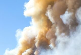


A Red Flag Warning is in effect across southern Nevada from 11 a.m. today until midnight, covering Esmeralda and Nye counties, the Sheep Range, the Spring Mountains, and Clark and southwest Lincoln counties, with south winds up to 35 mph and humidity as low as 5%.
A separate Red Flag Warning covers the Reno-Carson City-Minden corridor, where gusts could hit 65 mph in wind-prone spots. Between the two alerts, nearly the entire state is under some form of fire weather alert today.
The timing lands in what federal data show is already the most active wildfire year, by acreage, of at least the last decade. I
t also lands one day after a Reno public radio investigation found that a fifth of the people who filed damage claims from last month’s Hawk Fire have no home insurance at all, a gap made possible by a state law that took effect at the start of this year.
The Nation Has Already Burned More Land Than Any Year Since 2016
Through September 11, wildfires had burned 8,423,367 acres nationally in 2026, according to the National Interagency Fire Center, the federal agency that tracks fire statistics for every state. That is more acreage burned by this point in the year than in any of the ten years before it, including 2017’s previous high of 8,179,441 acres, a comparison calculated for this article from NIFC’s own year-by-year data.
It is also 92.8% more than the 4,369,143 acres burned by the same date last year, and about 51% above the ten-year average of roughly 5.58 million acres, both calculations original to this article.
Nevada has contributed heavily to that total. The Hawk Fire alone, which burned northwest of Reno starting in late August, reached 15,085 acres and 98% containment by September 1, after destroying 47 homes and killing one person.
A Fifth of Hawk Fire Claims Have No Insurance
The scale of that damage is now running into a coverage gap. According to disaster recovery company Bright Harbor’s tally, reported by Nevada Public Radio on Friday, 13 of the 59 people who have self-reported Hawk Fire damage so far say they have no home insurance. That works out to 22% of reported claims, a share calculated for this article since neither Bright Harbor nor the report framed the count as a percentage.
Part of that gap traces to Assembly Bill 376, a law that passed unanimously in June 2025 and took effect January 1, 2026, letting insurers carve wildfire coverage out of standard homeowner policies as part of a four-year regulatory sandbox. Nevada Insurance Commissioner Ned Gaines told the Nevada Independent that any insurer using the carve-out has to apply it statewide, not just in high-risk pockets: “They don’t get to pick and choose where they do that.
” Whether an individual Hawk Fire policyholder lost wildfire coverage depends on when their policy last renewed relative to that January 1 date, a detail insurers and homeowners are still working through claim by claim.
The gap is not confined to one burned neighborhood. Nevada’s Division of Insurance told Nevada Public Radio that more than 2,700 policies were canceled or not renewed for wildfire risk in 2024, the most the state has recorded in a single year. Separately, nearly 2,000 Nevadans had to find new coverage after a small carrier, Acuity, pulled out of the state’s homeowner market entirely last year, citing losses.
Two Zip Codes Under Today’s Warning Have Seen the Sharpest Denial Spikes
Two of the places named in a June report on Nevada’s insurance market fall inside today’s fire weather alerts. In Pahrump, zip code 89048, in southern Nye County, insurers denied just one homeowner application in 2022; by 2024 that had grown to 129, a 129-fold increase calculated for this article. Pahrump sits within the zone now under an active Red Flag Warning, not merely a watch, according to the National Weather Service’s own zone forecast for the area.
Henderson, zip code 89012, saw denials climb from four in 2023 to 160 in 2024, a 40-fold increase, also calculated for this article. Henderson sits inside the Las Vegas Valley zone, which the National Weather Service has placed under a Fire Weather Watch, one step below a full warning, for the same window as today’s warning elsewhere in the state.
Statewide, insurance application denials rose from 2,400 in 2022 to 13,000 in 2024, a more than fivefold increase, according to the same report, which cited Nevada’s own insurance data. Total homeowner policy cancellations and non-renewals across all causes reached 149,000 in 2024, of which the 2,700 wildfire-specific cancellations were a small but fast-growing slice.
- Southern Nevada, under warning now: Esmeralda and Nye counties, the Sheep Range, the Spring Mountains, and Clark and southwest Lincoln counties, 11 a.m. to midnight, winds to 35 mph, humidity as low as 5%.
- Northern Nevada, under warning now: Reno, Carson City and Minden, 11 a.m. Saturday to 2 a.m. Sunday, gusts to 65 mph in wind-prone areas.
- Pahrump (89048): Inside the active Red Flag Warning zone. Insurance denials rose from 1 in 2022 to 129 in 2024.
- Las Vegas Valley, including Henderson (89012): Under a Fire Weather Watch, one level below a warning. Denials in Henderson rose from 4 in 2023 to 160 in 2024.
None of this guarantees a fire will start in either place today. Red flag conditions describe the ingredients for rapid fire spread, not a location where a fire is already burning, and Nevada’s Division of Insurance has not said how many of the state’s wildfire-related denials specifically involve properties inside these warned zones.
What the numbers show is narrower and still notable: the two Nevada zip codes with the fastest-growing insurance denial rates in the state’s own data are also the two places carrying today’s fire weather alerts, one under a full warning and one under a watch.
Today’s Red Flag Warning and Fire Weather Watch details for southern Nevada, Pahrump and the Las Vegas Valley are drawn directly from National Weather Service zone forecast products. Northern Nevada warning details are drawn from KOLO 8 News Now’s September 11, 2026 report. National wildfire acreage figures for 2016 through 2026 are drawn from the National Interagency Fire Center’s year-to-date statistics, current as of September 11, 2026; the ten-year average, the year-over-year percentage change and the ranking of 2026 against the prior ten years are original calculations for this article. Hawk Fire acreage, containment and damage figures are drawn from Woodland Firefighter’s wildfire tracker. The 13-of-59 uninsured claims figure, the 2,700 wildfire-related 2024 cancellations, the Acuity market exit and Commissioner Gaines’s statutory framing are drawn from Nevada Public Radio’s September 11, 2026 report and the Nevada Independent’s report on Assembly Bill 376; the 22% share is an original calculation. Assembly Bill 376’s passage date and effective date are drawn from Insurance Business America’s August 24, 2026 report. Pahrump and Henderson zip code denial figures and statewide denial and cancellation totals are drawn from This Is Reno’s June 20, 2026 report on Nevada Division of Insurance data; the 129-fold, 40-fold and fivefold increase calculations are original to this article.